|
FOA News: 04 October 2023
Rome - One of the most innovative tools in water management and governance is going global.
WaPOR, as it is widely known, is expanding its geospatially driven coverage to the whole world, following six years of successful use in Africa and the Near East. The new and improved version was launched today at the Food and Agriculture Organization of the United Nations (FAO) at the 2nd Rome Water Dialogue and on the sidelines of the Global Symposium on Soils and Water.
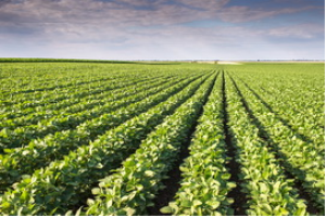
Water Productivity through Open access of Remotely sensed derived data, the portal’s full name, offers users near real-time satellite data to track actual water consumption in cropping fields, irrigation water applications and the economic value-addition that an extra drop can offer, doing so with seasonal nuance and high-spatial resolution. It can help countries, especially those grappling with water scarcity, monitor water productivity and identify productivity gaps. Irrigated agriculture accounts for 70 percent of global water withdrawals, so making every drop count is increasingly imperative.
“WaPOR can make important evidence-based contributions to bolstering the prospects for optimization and more reliable agricultural yields,” said Lifeng LI, Director of the FAO Land and Water Division.
The new version, tapping a wider array of satellite inputs and adapted to cutting-edge sensor technologies, increases the granularity of assessments, whose resolution can now bore down to field-scale applications where a pixel represents 20 meters of land surface, which can be used by farmers to decide when to irrigate and how much water is needed for their crops.
“We will get better data, allowing us to go beyond general numbers for entire countries,” said Jippe Hoogeveen, Chief Technical Advisor of the WaPOR programme. “This will allow governments to integrate the knowledge into more holistic, integrated, and targeted rural development plans, as well as contributing to better tracking of SDG6 objectives.
While the expanded WaPOR data are available to all FAO Member Countries and the public at large, Colombia and Pakistan are the first countries outside the original Africa and Near East zone to sign up for FAO capacity building support.
WaPOR and its new expanded iteration have been funded by the Government of the Netherlands.
How it works
WaPOR measures evapotranspiration, a key phase in the natural water cycle consisting of water that directly dissipates into the atmosphere through evaporation from soil and open water, and water that returns to the atmosphere after moving through a plant and emerging as vapor exuded by foliage. Using that, the platform can render, in pixelated maps, a picture of how much biomass and crop yield is produced per cubic meter of water consumed, allowing for calculation of crop water productivity.
There are numerous concrete applications, including improved crafting of water legislation or usage fees and quotas and irrigation advice to farmers. Ultimately, given the cost of pumping water, these could even extend to determining energy prices.
WaPOR contributes significantly to assessing the marginal cost or value-added of water use, which can allow planning authorities and stakeholders, including smallholder farmers, to make better informed decisions, which may not always entail reducing water usage.
For example, borrowing from a case study of using WaPOR in Lebanon’s Bekaa Valley, if spring potatoes are ten times more profitable than wheat, but require more water, it might be of interest to find a balance between food security and income generation priorities. Such decisions would best be guided by gains at the margin, both in terms of market prices and water utilization. WaPOR can be used to calculate economic irrigation water productivity, to facilitate just that kind of decision making.
Geospatial data is complemented by empirical work on the ground and can help determine what needs to be done. If WaPOR pixels point to high water productivity farms next to low productivity farms, a field trip might flesh out whether more targeted but replicable agricultural practices are behind the difference.
The World Bank, the European Bank for Reconstruction and Development, the African Development Bank, the Green Climate fund, the Global Environment Facility, and other top-tier development institutions and financial mechanisms are all using WaPOR in some of their initiatives.
To broaden the menu, FAO is embedding the WaPOR portal into its Hand-in-Hand Geospatial Platform, which allows it to contribute to more country-led investment projects in rural development.
See https://www.fao.org/newsroom/detail/fao-broadens-scope-of-innovative-water-monitoring-tool-to-include-the-whole-world/en
|
[ Other News ]___________________________________________________
|
 Curently online :
32
Curently online :
32 Total visitors :
7651705
Total visitors :
7651705